
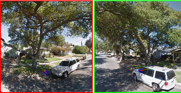
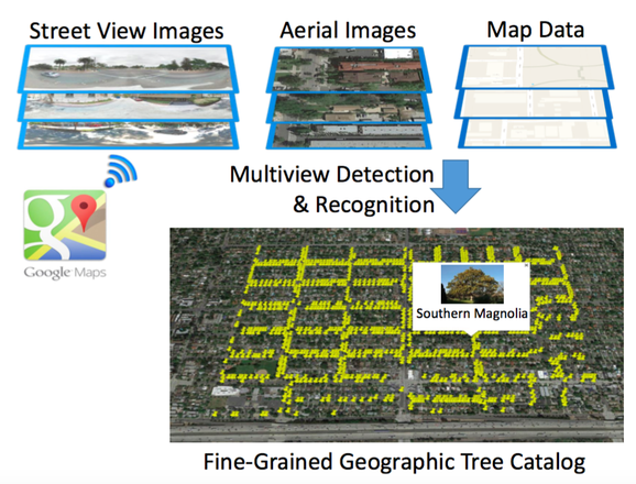
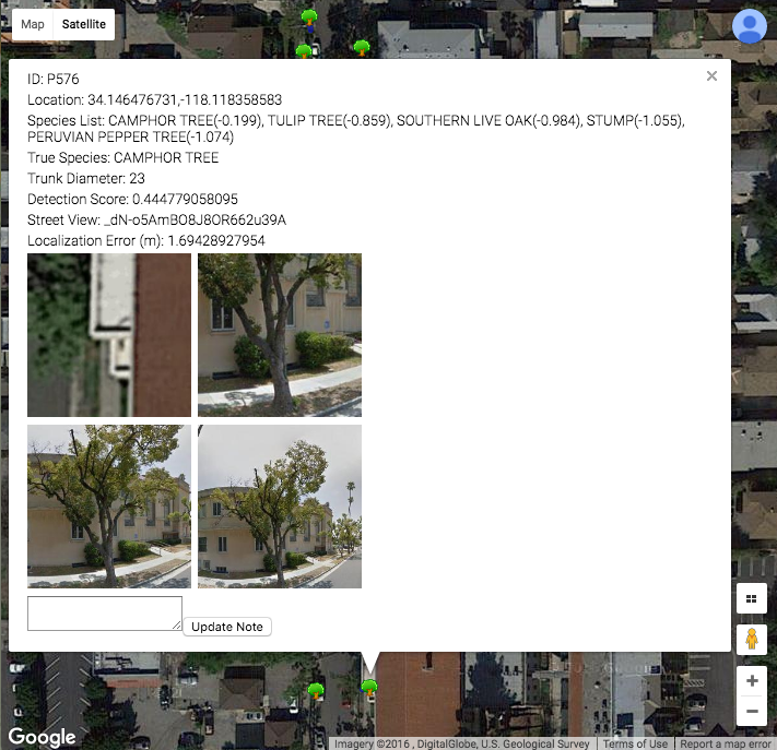
About Our ProjectWe have developed an automated system that can detect and inventory street trees automatically. From publicly available imagery (Google maps and Google Street View at the moment) of a city, our system produces a list of the location, species and trunk diameter of each street tree.
|
|
AN ALGORITHM TO CATALOG STREET TREES
How It Works
|
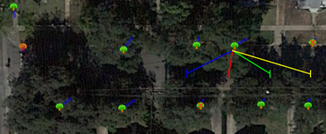
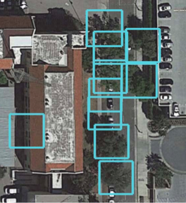
Our approach uses deep learning to identify the location of a tree, classify its species, and approximate its trunk diameter. It combines publicly available geo-referenced Google Maps aerial and street view images along with map data to provide a comprehensive and accurate catalog of street trees.
|
ApplicationOur algorithm can be used to build an inventory that allows cities to better manage street trees. Cities may detect areas where trees are getting old and need replanting, create an inventory of empty locations where trees may be planted, or detect streets where trees need pruning.
|
|
|


|
CollaboratorsETH ZurichJan Dirk Wegner
Nico Lang Ahmed Nassar Konrad Schindler Caltech |